
1953 Map of Hadley
USGS Topo · Published 1954About this map
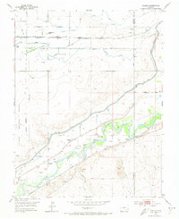
The Arkansas River corridor in the early 1950s reveals a landscape defined by industrial water management and frontier history. This portion of the valley, straddling the Otero and Bent County line, is marked by the presence of the Old Fort Bent (Ruins) and a corresponding Historical Marker, anchoring the map to Colorado's early trade era. The settlement at Hadley and the nearby Fort Bent School serve as local hubs, while the Atchison Topeka and Santa Fe railroad parallels the river, facilitating the transport of agricultural and mineral resources.
Find a feature on this map
21 named features on this map. Tap any name to fly to it.
Don’t see what you’re looking for? This feature index may not catch every label — zoom into the map to look around manually.
Map Details
Editions of this 1953 Hadley Map
3 editions found
Other maps of this area

1891 · Catlin
USGS Topo · 1:125,000

1891 · Higbee
USGS Topo · 1:125,000

1891 · Las Animas
USGS Topo · 1:125,000

1891 · Timpas
USGS Topo · 1:125,000

1893 · Higbee
USGS Topo · 1:125,000

1893 · Las Animas
USGS Topo · 1:125,000

1893 · Catlin
USGS Topo · 1:125,000

1894 · Timpas
USGS Topo · 1:125,000

1953 · Cheraw
USGS Topo · 1:24,000

1953 · Cornelia
USGS Topo · 1:24,000