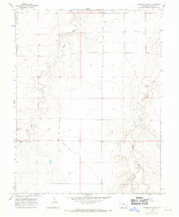
1966 Map of Toonerville NE
USGS Topo · Published 1969About this map
Rule Creek and Caddoa Creek carve distinct drainages through this section of Bent County, reflecting the arid landscape's reliance on intermittent water sources. The mid-1960s terrain is marked by a mix of natural erosion and human utility, evidenced by the presence of Mans Ditch and a centrally located Landing Strip. These features, along with several scattered wells, indicate the pastoral and light industrial activity common to this part of the Colorado high plains. The inclusion of Gravel Pits in the southwest corner and the curiously named Poor drainage further detail the local geography. This survey provides a precise look at the land use and drainage patterns before later modern developments, offering a clear view of the rural infrastructure from the mid-century era.
Find a feature on this map
11 named features on this map. Tap any name to fly to it.
Don’t see what you’re looking for? This feature index may not catch every label — zoom into the map to look around manually.
Map Details
Editions of this 1966 Toonerville NE Map
This is the sole edition of this map. No revisions or reprints were ever made.
Other maps of this area

1891 · Higbee
USGS Topo · 1:125,000

1891 · Las Animas
USGS Topo · 1:125,000

1892 · Lamar
USGS Topo · 1:125,000

1892 · Two Butte
USGS Topo · 1:125,000

1893 · Higbee
USGS Topo · 1:125,000

1893 · Two Butte
USGS Topo · 1:125,000

1893 · Las Animas
USGS Topo · 1:125,000

1953 · Hasty
USGS Topo · 1:24,000

1953 · Las Animas
USGS Topo · 1:24,000

1953 · Kreybill
USGS Topo · 1:24,000