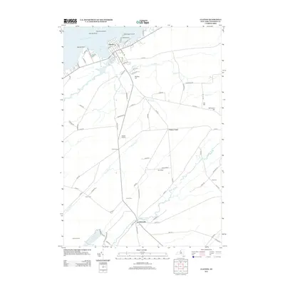
2013 Map of Clayton
USGS Topo · Published 2013About this map
The waterfront town of Clayton serves as a gateway to the Thousand Islands region, situated along the Saint Lawrence River at the mouths of French Creek Bay and Goose Bay. The map captures the interface between the river's deep-water navigation channels, marked by Calumet Shoal, and the agricultural interior of Jefferson County. Further south, the settlement of Depauville lies along the winding banks of the Chaumont River, illustrating the historical importance of waterway access for early rural development. Genealogy researchers can locate several small burial grounds, including Dutch Cem, Corbin Cem, and Weaver Cem, which are scattered among the ridges and flats. The landscape transitions from the riverfront activity near Washington Island and Steele Point to the high ground of McCarn Hill and Schnauber Hill, while local aviation history is represented by Ritchie Airfield.
Find a feature on this map
85 named features on this map. Tap any name to fly to it.
Don’t see what you’re looking for? This feature index may not catch every label — zoom into the map to look around manually.
Map Details
Editions of this 2013 Clayton Map
This is the sole edition of this map. No revisions or reprints were ever made.
Other maps of this area

1900 · Clayton
USGS Topo · 1:62,500

1903 · Grindstone
USGS Topo · 1:62,500

1903 · Clayton
USGS Topo · 1:62,500

1903 · Alexandria Bay
USGS Topo · 1:62,500

1903 · Theresa
USGS Topo · 1:62,500

1942 · Chaumont
USGS Topo · 1:31,680

1942 · Sawmill Bay
USGS Topo · 1:31,680

1942 · Clayton
USGS Topo · 1:24,000
1943 · Dexter
USGS Topo · 1:31,680

1943 · Thousand Island Park
USGS Topo · 1:31,680