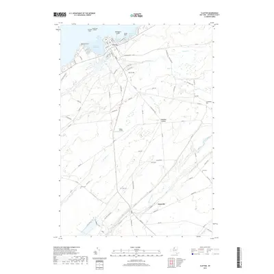
2019 Map of Clayton
USGS Topo · Published 2019About this map
The Saint Lawrence River shoreline defines the northern edge of this Jefferson County landscape, where the village of Clayton serves as a gateway to the water via French Creek Bay and Carrier Bay. Inland, the terrain transitions from the riverfront to agricultural uplands and marshy lowlands drained by the Chaumont River and Three Mile Cr. The settlement patterns here are deeply rooted in the 19th-century history of the region, visible in the cluster at Depauville and the smaller crossroads of Clayton Center.
Find a feature on this map
83 named features on this map. Tap any name to fly to it.
Don’t see what you’re looking for? This feature index may not catch every label — zoom into the map to look around manually.
Map Details
Editions of this 2019 Clayton Map
This is the sole edition of this map. No revisions or reprints were ever made.
Other maps of this area

1900 · Clayton
USGS Topo · 1:62,500

1903 · Grindstone
USGS Topo · 1:62,500

1903 · Clayton
USGS Topo · 1:62,500

1903 · Alexandria Bay
USGS Topo · 1:62,500

1903 · Theresa
USGS Topo · 1:62,500

1942 · Chaumont
USGS Topo · 1:31,680

1942 · Sawmill Bay
USGS Topo · 1:31,680

1942 · Clayton
USGS Topo · 1:24,000
1943 · Dexter
USGS Topo · 1:31,680

1943 · Thousand Island Park
USGS Topo · 1:31,680