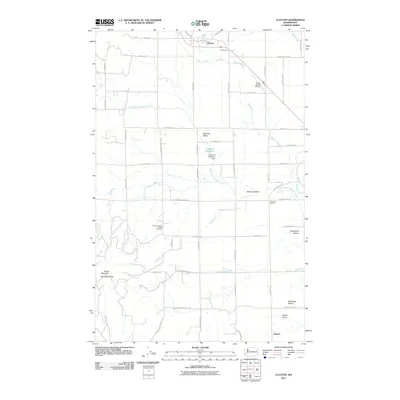
2011 Map of Clayton
USGS Topo · Published 2011About this map
Clayton serves as the primary settlement in this part of Stevens County, situated near the headwaters of Beaver Creek. The landscape transitions from the agricultural flats of Wild Rose Prairie and Big Foot Valley into more varied terrain marked by Turpentine Hollow and the prominent Dunns Mountain. Water management is central to the area's development, evidenced by the Lenhard Reservoir Dam and the network of drainages including West Branch Dragoon Creek and Mud Creek. A rural infrastructure of longstanding family-named landmarks like Christiansons and Keystone Corners defines the community layout. Genealogists will find the Williams Valley Hillside Cemetery positioned near Williams Valley, while the presence of small airfields such as Cross Winds Airport and Fielding Airport reflects the spread-out nature of this Eastern Washington locality.
Find a feature on this map
56 named features on this map. Tap any name to fly to it.
Don’t see what you’re looking for? This feature index may not catch every label — zoom into the map to look around manually.
Map Details
Editions of this 2011 Clayton Map
This is the sole edition of this map. No revisions or reprints were ever made.
Other maps of this area

1901 · Spokane
USGS Topo · 1:125,000

1927 · Chewelah
USGS Topo · 1:125,000

1930 · Chewelah
USGS Topo · 1:125,000

1936 · Newport
USGS Topo · 1:96,000

1942 · Newport
USGS Topo · 1:125,000

1944 · Clayton
USGS Topo · 1:62,500

1949 · Deer Park
USGS Topo · 1:62,500

1950 · Clayton
USGS Topo · 1:62,500

1951 · Deer Park
USGS Topo · 1:62,500

1955 · Spokane
USGS Topo · 1:250,000