
1955 Map of Spokane
USGS Topo · Published 1965About this map
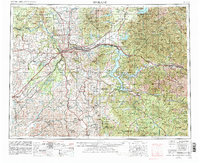
Spokane serves as the metropolitan anchor of the Inland Empire in this mid-century portrait of eastern Washington and northern Idaho. The city is surrounded by a dense network of suburban developments like Opportunity and Dishman, while the western plains are dominated by the sprawling operations at Fairchild Air Force Base and Geiger Field. The regional economy is clearly defined by its geography, from the agricultural reaches of Peone Prairie to the industrial heart of the Coeur d’Alene mining district in the east, where the Bunker Hill Mine and Sunshine Mine mark a landscape of heavy extraction.
Find a feature on this map
332 named features on this map. Tap any name to fly to it.
Don’t see what you’re looking for? This feature index may not catch every label — zoom into the map to look around manually.
Map Details
Editions of this 1955 Spokane Map
2 editions found
Other maps of this area

1901 · Sandpoint
USGS Topo · 1:125,000

1901 · Spokane
USGS Topo · 1:125,000

1901 · Coeur D'Alene District
USGS Topo · 1:62,500

1903 · Oakesdale
USGS Topo · 1:125,000

1903 · Rathdrum
USGS Topo · 1:125,000

1903 · Coeur D'Alene District
USGS Topo · 1:62,500

1905 · Oakesdale
USGS Topo · 1:125,000

1906 · Coeur D'Alene District
USGS Topo · 1:62,500

1909 · Cataldo
USGS Topo · 1:125,000

1910 · Pullman
USGS Topo · 1:125,000