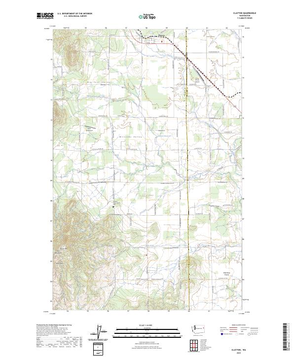
2023 Map of Clayton
USGS Topo · Published 2023About this map
Clayton serves as the primary settlement on this landscape, positioned along the northern boundary where the rail line and Highway 395 intersect. This area transitions from the high peaks of Twin Mountains and Dunns Mtn in the southwest to the broad, fertile agricultural expanses of Big Foot Valley and Williams Valley. The agricultural heritage of the region is evident in the network of family-named roads and landmarks, including the Williams Valley Hillside Cem and several private airfields like Cross Winds Airport and Deer Flat Airport.
Find a feature on this map
74 named features on this map. Tap any name to fly to it.
Don’t see what you’re looking for? This feature index may not catch every label — zoom into the map to look around manually.
Map Details
Editions of this 2023 Clayton Map
This is the sole edition of this map. No revisions or reprints were ever made.
Other maps of this area

1901 · Spokane
USGS Topo · 1:125,000

1927 · Chewelah
USGS Topo · 1:125,000

1930 · Chewelah
USGS Topo · 1:125,000

1936 · Newport
USGS Topo · 1:96,000

1942 · Newport
USGS Topo · 1:125,000

1944 · Clayton
USGS Topo · 1:62,500

1949 · Deer Park
USGS Topo · 1:62,500

1950 · Clayton
USGS Topo · 1:62,500

1951 · Deer Park
USGS Topo · 1:62,500

1955 · Spokane
USGS Topo · 1:250,000