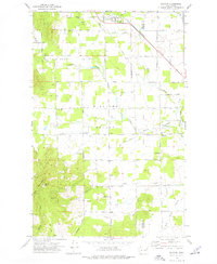
1973 Map of Clayton
USGS Topo · Published 1976About this map
Clayton serves as the primary northern hub in this rural landscape straddling the line between Stevens and Spokane counties. The area is defined by a series of north-south valleys, most notably Big Foot Valley and Williams Valley, where agricultural life is anchored by civic landmarks like the Grange Hall and the Community Center. The Burlington Northern railroad cuts a diagonal path through the northern flats, reflecting the region's historical reliance on rail for transporting timber and livestock from the surrounding mountains.
Find a feature on this map
59 named features on this map. Tap any name to fly to it.
Don’t see what you’re looking for? This feature index may not catch every label — zoom into the map to look around manually.
Map Details
Editions of this 1973 Clayton Map
This is the sole edition of this map. No revisions or reprints were ever made.
Other maps of this area

1901 · Spokane
USGS Topo · 1:125,000

1927 · Chewelah
USGS Topo · 1:125,000

1930 · Chewelah
USGS Topo · 1:125,000

1936 · Newport
USGS Topo · 1:96,000

1942 · Newport
USGS Topo · 1:125,000

1944 · Clayton
USGS Topo · 1:62,500

1949 · Deer Park
USGS Topo · 1:62,500

1950 · Clayton
USGS Topo · 1:62,500

1951 · Deer Park
USGS Topo · 1:62,500

1955 · Spokane
USGS Topo · 1:250,000