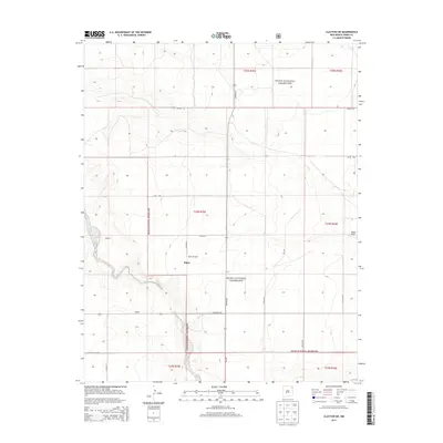
2013 Map of Clayton SW
USGS Topo · Published 2013About this map
Kiowa National Grassland dominates this high plains landscape in Union County, where section lines and rural tracks define a sparse network of ranching settlements. The small community of Bates is central to the area, supported by landmarks like the Bates Windmill and nearby water sources such as Carrizo Cr and Sand Draw. This 2013 survey illustrates the enduring nature of New Mexico's ranching country, where large tracts of public land are interspersed with isolated homestead sites like Webster and Walker. The road system, including Hwy SR 562 and NM-402, provides the primary connections across these vast grasslands, reflecting a landscape where geography and infrastructure remain tied to the cattle economy and land management of the western plains.
Find a feature on this map
23 named features on this map. Tap any name to fly to it.
Don’t see what you’re looking for? This feature index may not catch every label — zoom into the map to look around manually.
Map Details
Editions of this 2013 Clayton SW Map
This is the sole edition of this map. No revisions or reprints were ever made.
Other maps of this area

1954 · Dalhart
USGS Topo · 1:250,000

1958 · Dalhart
USGS Topo · 1:250,000

1962 · Dalhart
USGS Topo · 1:250,000

1966 · Royce
USGS Topo · 1:24,000

1966 · Clapham
USGS Topo · 1:24,000

1966 · Sand Hill
USGS Topo · 1:24,000

1970 · Texline South
USGS Topo · 1:24,000

1970 · Clayton
USGS Topo · 1:24,000

1970 · Clayton SW
USGS Topo · 1:24,000

1970 · Texline North
USGS Topo · 1:24,000