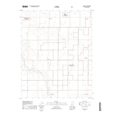
2020 Map of Clayton SW
USGS Topo · Published 2020About this map
Kiowa National Grassland dominates this corner of Union County, reflecting a landscape defined by federal conservation and high-plains grazing. The terrain is marked by the seasonal drainage of Carrizo Cr and the wide expanse of Sand Draw, features that dictated the location of ranching infrastructure and early road networks. The map details a grid of rural routes such as Campsey Ln and Toney Rd that link isolated homesteads and pastures across the townships. A notable point of interest is the label for Plainview, positioned near the intersection of Hwy Sr 562, which hints at the localized community centers that served this ranching region in the early 21st century. The survey provides a clear view of the Public Land Survey System boundaries, including t24n r35e and t25n r36e, which remain foundational to property ownership in this part of New Mexico.
Find a feature on this map
20 named features on this map. Tap any name to fly to it.
Don’t see what you’re looking for? This feature index may not catch every label — zoom into the map to look around manually.
Map Details
Editions of this 2020 Clayton SW Map
This is the sole edition of this map. No revisions or reprints were ever made.
Other maps of this area

1954 · Dalhart
USGS Topo · 1:250,000

1958 · Dalhart
USGS Topo · 1:250,000

1962 · Dalhart
USGS Topo · 1:250,000

1966 · Royce
USGS Topo · 1:24,000

1966 · Clapham
USGS Topo · 1:24,000

1966 · Sand Hill
USGS Topo · 1:24,000

1970 · Texline South
USGS Topo · 1:24,000

1970 · Clayton
USGS Topo · 1:24,000

1970 · Clayton SW
USGS Topo · 1:24,000

1970 · Texline North
USGS Topo · 1:24,000