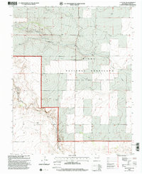
1998 Map of Clayton SW
USGS Topo · Published 2001About this map
Kiowa National Grassland dominates this landscape in northeastern New Mexico, where the high plains are carved by seasonal watercourses and drainage patterns. The topography reflects a sparsely populated ranching environment during the late 1990s, characterized by intermittent water features such as Sand Draw and the winding course of Carrizo Creek. Small localized settlements and family-named landmarks like Bates and Walker provide essential context for genealogical research, pinpointing specific habitations in this open Union County terrain. A local Gravel Pit indicates small-scale industrial activity, while the intricate contour lines reveal the subtle elevation changes of the draws and mesas that define the regional geography. This survey provides a clear look at land management and rural settlement patterns before the turn of the twenty-first century.
Find a feature on this map
6 named features on this map. Tap any name to fly to it.
Don’t see what you’re looking for? This feature index may not catch every label — zoom into the map to look around manually.
Map Details
Editions of this 1998 Clayton SW Map
This is the sole edition of this map. No revisions or reprints were ever made.
Other maps of this area

1954 · Dalhart
USGS Topo · 1:250,000

1958 · Dalhart
USGS Topo · 1:250,000

1962 · Dalhart
USGS Topo · 1:250,000

1966 · Royce
USGS Topo · 1:24,000

1966 · Clapham
USGS Topo · 1:24,000

1966 · Sand Hill
USGS Topo · 1:24,000

1970 · Texline South
USGS Topo · 1:24,000

1970 · Clayton
USGS Topo · 1:24,000

1970 · Clayton SW
USGS Topo · 1:24,000

1970 · Texline North
USGS Topo · 1:24,000