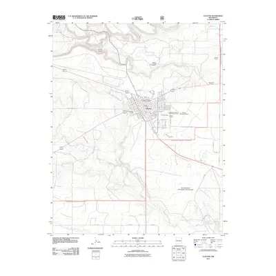
2011 Map of Clayton
USGS Topo · Published 2011About this map
Clayton serves as a vital hub in the high plains of Northeast New Mexico, where the town’s grid is flanked by the Rita Blanca National Grassland. The landscape is defined by drainage systems like Apache Creek and Perico Creek, which carve through the terrain near the prominent Apache Canyon. This 2011 survey captures the town's infrastructure, including the Clayton Municipal Airport and the Kiowa and Rita Blanca Ranger District Office.
Find a feature on this map
63 named features on this map. Tap any name to fly to it.
Don’t see what you’re looking for? This feature index may not catch every label — zoom into the map to look around manually.
Map Details
Editions of this 2011 Clayton Map
This is the sole edition of this map. No revisions or reprints were ever made.
Other maps of this area

1954 · Dalhart
USGS Topo · 1:250,000

1958 · Dalhart
USGS Topo · 1:250,000

1962 · Dalhart
USGS Topo · 1:250,000

1966 · Royce
USGS Topo · 1:24,000

1966 · Sand Hill
USGS Topo · 1:24,000

1970 · Texline South
USGS Topo · 1:24,000

1970 · Clayton
USGS Topo · 1:24,000

1970 · Clayton SW
USGS Topo · 1:24,000

1970 · Texline North
USGS Topo · 1:24,000

1972 · Bible Top Butte
USGS Topo · 1:24,000