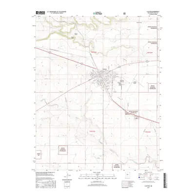
2017 Map of Clayton
USGS Topo · Published 2017About this map
Clayton serves as the focal point of this northeastern New Mexico landscape, where the High Plains transition into the breaks of Apache Canyon. The town's grid is oriented along the Burlington Northern Santa Fe railway, reflecting its long-standing history as a shipping and transit hub. Several burial grounds, including the Independent Order of Odd Fellows Cem, the County Cem, and the Clayton Cem, are clustered southeast of the main settlement near the Clayton Municipal Airpark. The surrounding territory is defined by the Kiowa National Grassland, with water sources like Apache Spring and Perico Cr cutting through the terrain. This survey illustrates the relationship between the concentrated urban center of Clayton and the expansive, conserved grasslands that dominate the region's geography.
Find a feature on this map
71 named features on this map. Tap any name to fly to it.
Don’t see what you’re looking for? This feature index may not catch every label — zoom into the map to look around manually.
Map Details
Editions of this 2017 Clayton Map
This is the sole edition of this map. No revisions or reprints were ever made.
Other maps of this area

1954 · Dalhart
USGS Topo · 1:250,000

1958 · Dalhart
USGS Topo · 1:250,000

1962 · Dalhart
USGS Topo · 1:250,000

1966 · Royce
USGS Topo · 1:24,000

1966 · Sand Hill
USGS Topo · 1:24,000

1970 · Texline South
USGS Topo · 1:24,000

1970 · Clayton
USGS Topo · 1:24,000

1970 · Clayton SW
USGS Topo · 1:24,000

1970 · Texline North
USGS Topo · 1:24,000

1972 · Bible Top Butte
USGS Topo · 1:24,000