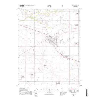
2020 Map of Clayton
USGS Topo · Published 2020About this map
The high plains town of Clayton serves as a vital hub where the Burlington Northern Santa Fe railway intersects with routes leading into the Kiowa National Grassland. This survey provides a look at the civic heart of the community, anchored by the Union County courthouse and a well-defined grid of streets such as Monroe St and Adams St. The landscape is characterized by the dramatic drainage of Apache Canyon and Apache Valley to the north, while the southern reaches are marked by the winding path of Perico Cr. For those tracing local heritage, the map identifies three distinct burial grounds east of the town center: the Clayton Cem, the County Cem, and the Independent Order of Odd Fellows Cem.
Find a feature on this map
68 named features on this map. Tap any name to fly to it.
Don’t see what you’re looking for? This feature index may not catch every label — zoom into the map to look around manually.
Map Details
Editions of this 2020 Clayton Map
This is the sole edition of this map. No revisions or reprints were ever made.
Other maps of this area

1954 · Dalhart
USGS Topo · 1:250,000

1958 · Dalhart
USGS Topo · 1:250,000

1962 · Dalhart
USGS Topo · 1:250,000

1966 · Royce
USGS Topo · 1:24,000

1966 · Sand Hill
USGS Topo · 1:24,000

1970 · Texline South
USGS Topo · 1:24,000

1970 · Clayton
USGS Topo · 1:24,000

1970 · Clayton SW
USGS Topo · 1:24,000

1970 · Texline North
USGS Topo · 1:24,000

1972 · Bible Top Butte
USGS Topo · 1:24,000