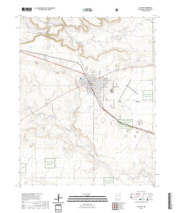
2023 Map of Clayton
USGS Topo · Published 2023About this map
Clayton serves as a critical high-plains hub in this northeastern New Mexico survey, dominated by a dense grid of streets such as Main St, E Broadway St, and Beech St. The town center is anchored by the Union County Courthouse, while the surrounding landscape transitions into the wide expanses of the Kiowa National Grassland. This 2023 edition documents the enduring importance of the Burlington Northern Santa Fe railroad corridor, which cuts diagonally across the township lines of T26N R35E and R36E.
Find a feature on this map
66 named features on this map. Tap any name to fly to it.
Don’t see what you’re looking for? This feature index may not catch every label — zoom into the map to look around manually.
Map Details
Editions of this 2023 Clayton Map
This is the sole edition of this map. No revisions or reprints were ever made.
Other maps of this area

1954 · Dalhart
USGS Topo · 1:250,000

1958 · Dalhart
USGS Topo · 1:250,000

1962 · Dalhart
USGS Topo · 1:250,000

1966 · Royce
USGS Topo · 1:24,000

1966 · Sand Hill
USGS Topo · 1:24,000

1970 · Texline South
USGS Topo · 1:24,000

1970 · Clayton
USGS Topo · 1:24,000

1970 · Clayton SW
USGS Topo · 1:24,000

1970 · Texline North
USGS Topo · 1:24,000

1972 · Bible Top Butte
USGS Topo · 1:24,000