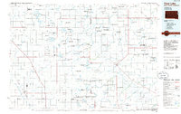
1985 Map of Clear Lake
USGS Topo · Published 1985About this map
The Big Sioux River and the high ground of Buffalo Hill anchor this mid-1980s look at the borderlands between South Dakota and Minnesota. The region is defined by a dense network of managed lands, including the Sioux Nation State Wildlife Management Area and numerous waterfowl production sites, reflecting the critical role of the glacial prairie pothole landscape. Small prairie towns such as Toronto, Astoria, and Estelline are connected by a grid of rural roads and the tracks of the Chicago and North Western and Burlington Northern railroads. A notable piece of transportation history is visible in the Old Railroad Grade north of Goodwin, marking a bypass or decommissioned segment of the rail network. The area’s geography is further characterized by large water bodies like Lake Cochrane and Lake Hendricks, which sit along the state line, serving as focal points for local recreation and conservation.
Find a feature on this map
121 named features on this map. Tap any name to fly to it.
Don’t see what you’re looking for? This feature index may not catch every label — zoom into the map to look around manually.
Map Details
Editions of this 1985 Clear Lake Map
2 editions found
Other maps of this area

1953 · Bellingham
USGS Topo · 1:62,500

1953 · Milbank
USGS Topo · 1:250,000

1953 · Watertown
USGS Topo · 1:250,000

1953 · New Ulm
USGS Topo · 1:250,000

1953 · Saint Cloud
USGS Topo · 1:250,000

1957 · Saint Cloud
USGS Topo · 1:250,000

1957 · New Ulm
USGS Topo · 1:250,000

1958 · New Ulm
USGS Topo · 1:250,000

1958 · Milbank
USGS Topo · 1:250,000

1958 · Watertown
USGS Topo · 1:250,000