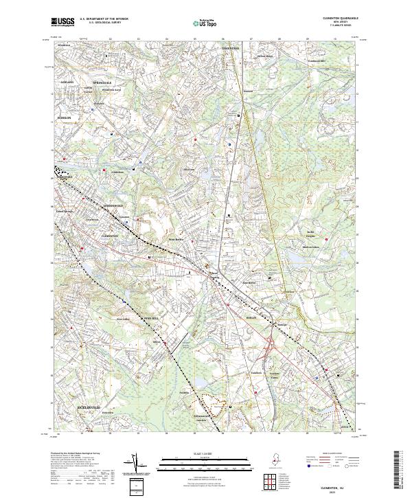
2023 Map of Clementon
USGS Topo · Published 2023About this map
Clementon and its surrounding boroughs are defined by a complex network of small lakes and the headwaters of the Great Egg Harbor River. This landscape is densely interspersed with cemeteries and burial grounds that reflect the long-standing community roots in the area, from the historic Matlack Family Burial Ground in the north to the Atco Cem in the southeast. The urban development of Lindenwold, Stratford, and Gibbsboro follows established corridors like the White Horse Pike and the Haddonfield Berlin Rd, showing how modern suburban expansion has grown around traditional settlement nodes.
Find a feature on this map
127 named features on this map. Tap any name to fly to it.
Don’t see what you’re looking for? This feature index may not catch every label — zoom into the map to look around manually.
Map Details
Editions of this 2023 Clementon Map
This is the sole edition of this map. No revisions or reprints were ever made.
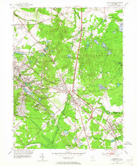
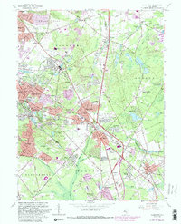
Historical Maps of Tansboro Through Time
3 maps found