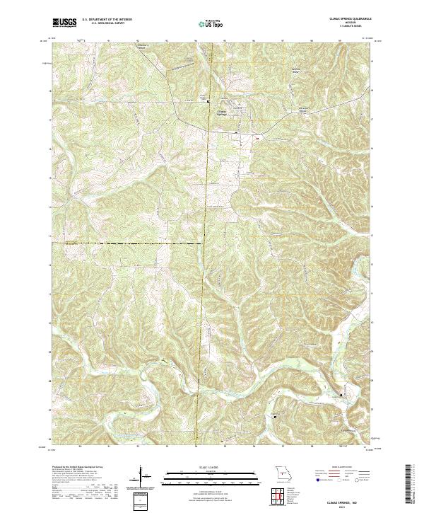
2021 Map of Climax Springs
USGS Topo · Published 2021About this map
The town of Climax Springs serves as the focal point for this survey of the Ozark highlands, where the borders of Benton, Camden, and Hickory counties converge. The landscape is defined by the winding course of the Little Niangua River and its numerous tributaries, including Starks Cr and Fiery Fork. These waterways have carved a complex series of ridges and hollows, such as Canfield Ridge and Coffee Hollow, which have long dictated the placement of roads and homesteads. Local history is preserved in several small burial sites, including Climax Springs Cem, Creach Cem, and Green Cem. Transportation patterns are revealed through a network of rural routes like State Hwy NN and State Hwy AA, alongside the Miller Airport and the expansive Climax Springs Ranch. The map also captures the settlement at Macks Cr near the river's edge, illustrating the enduring relationship between the community and the river valley's topography.
Find a feature on this map
77 named features on this map. Tap any name to fly to it.
Don’t see what you’re looking for? This feature index may not catch every label — zoom into the map to look around manually.
Map Details
Editions of this 2021 Climax Springs Map
This is the sole edition of this map. No revisions or reprints were ever made.
Other maps of this area

1884 · Bolivar
USGS Topo · 1:125,000

1887 · Warsaw
USGS Topo · 1:125,000

1888 · Versailles
USGS Topo · 1:125,000

1892 · Bolivar
USGS Topo · 1:125,000

1893 · Versailles
USGS Topo · 1:125,000

1894 · Warsaw
USGS Topo · 1:125,000

1934 · Macks Creek
USGS Topo · 1:48,000

1934 · Irontown Ferry
USGS Topo · 1:24,000

1935 · Barnumton
USGS Topo · 1:24,000

1935 · Edwards
USGS Topo · 1:24,000