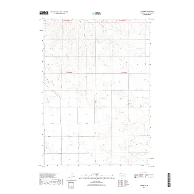
2017 Map of Clinton SW
USGS Topo · Published 2017About this map
Amity Cem sits near the center of this rural landscape in Sheridan County, illustrating the sparse settlement pattern characteristic of the Nebraska Panhandle. The terrain is defined by the drainage of Larrabee Cr and Antelope Cr, which cut through the high plains. Human presence is marked primarily by a grid of section lines and named thoroughfares such as Scott Rd and Church Rd. To the southeast, the Frank Reservoir provides a localized water source, a critical feature for the ranching and agricultural operations in this semi-arid region. This 2017 study reflects the enduring nature of the local road network, where historical trail remnants like 325 Trl and 323 Trl still trace their way across the modern township and range divisions.
Find a feature on this map
28 named features on this map. Tap any name to fly to it.
Don’t see what you’re looking for? This feature index may not catch every label — zoom into the map to look around manually.
Map Details
Editions of this 2017 Clinton SW Map
This is the sole edition of this map. No revisions or reprints were ever made.
Other maps of this area

1955 · Alliance
USGS Topo · 1:250,000

1957 · Alliance
USGS Topo · 1:250,000

1958 · Alliance
USGS Topo · 1:250,000

1966 · Rushville
USGS Topo · 1:24,000

1966 · Hay Springs NE
USGS Topo · 1:24,000

1969 · Clinton
USGS Topo · 1:24,000

1969 · Whiteclay
USGS Topo · 1:24,000

1969 · Clinton NW
USGS Topo · 1:24,000

1969 · Clinton NE
USGS Topo · 1:24,000

1969 · Clinton SW
USGS Topo · 1:24,000