
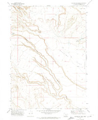
1971 Map of Clover Swale
USGS Topo · Published 1974About this map
Clover Swale and the surrounding high desert plateau of Harney County are defined by a network of seasonal water sources and deep canyons carved into the volcanic landscape. In the early 1970s, this area remained largely primitive, accessible primarily by a network of Jeep Trails that connect isolated stock water points like O'Keefe Reservoir, Kerns Waterhole, and Gravel Waterhole. The presence of several corrals near Springs and a Dry Well reflects the enduring importance of rangeland management in this arid territory.
Find a feature on this map
39 named features on this map. Tap any name to fly to it.
Don’t see what you’re looking for? This feature index may not catch every label — zoom into the map to look around manually.
Map Details
Editions of this 1971 Clover Swale Map
This is the sole edition of this map. No revisions or reprints were ever made.
Other maps of this area

1955 · Burns
USGS Topo · 1:250,000

1955 · Adel
USGS Topo · 1:250,000

1957 · Adel
USGS Topo · 1:250,000

1958 · Burns
USGS Topo · 1:250,000

1958 · Adel
USGS Topo · 1:250,000

1959 · Burns
USGS Topo · 1:250,000

1962 · Adel
USGS Topo · 1:250,000

1971 · Duhaime Flat East
USGS Topo · 1:24,000

1971 · Orejana Canyon
USGS Topo · 1:24,000
1971 · Duhaime Flat West
USGS Topo · 1:24,000