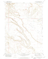
1971 Map of Duhaime Flat West
USGS Topo · Published 1974About this map
Augustine Gilbert Place serves as a lone marker of human settlement in this high-desert landscape of Harney County. Situated near the northern edge of the sheet, the site overlooks the complex drainage systems of Augustin Canyon and Buckhorn Canyon. These deep-cut ravines define the local topography, leading toward the expansive basin of the Duhaime Flat Depression to the southeast. Water remains the critical factor for survival and navigation here, evidenced by the strategic locations of Augustin Spring, Buckhorn Spring, and Little Mud Spring.
Find a feature on this map
12 named features on this map. Tap any name to fly to it.
Don’t see what you’re looking for? This feature index may not catch every label — zoom into the map to look around manually.
Map Details
Editions of this 1971 Duhaime Flat West Map
This is the sole edition of this map. No revisions or reprints were ever made.
Other maps of this area

1955 · Adel
USGS Topo · 1:250,000

1957 · Adel
USGS Topo · 1:250,000

1958 · Adel
USGS Topo · 1:250,000

1962 · Adel
USGS Topo · 1:250,000

1971 · Duhaime Flat East
USGS Topo · 1:24,000

1971 · Clover Swale
USGS Topo · 1:24,000

1971 · Orejana Canyon
USGS Topo · 1:24,000
1971 · Sixmile Draw
USGS Topo · 1:24,000
1971 · Keg Sprs Valley West
USGS Topo · 1:24,000
1971 · Blitzen NW
USGS Topo · 1:24,000