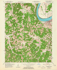
1953 Map of Cloverport
USGS Topo · Published 1965About this map
Cloverport sits prominently along the south bank of the Ohio River in Kentucky, facing across to Tobinsport on the Indiana side. In the early 1950s, the region was defined by its dissected topography and the network of waterways like Caney Creek and Little Blackford Creek that carved through the hills. This survey records a landscape of small crossroads and rural centers such as Patesville, Sunny Corner, and Arrington Corner. Evidence of local industry is found in the scattered Oil Wells and the strip mining activity noted in the margin. Religious and community life is anchored by landmarks like Bethlehem Ch and St Rose Cem, while the proximity to the river influenced the placement of settlements and transport routes across the Hancock Co / Breckinridge Co line.
Find a feature on this map
41 named features on this map. Tap any name to fly to it.
Don’t see what you’re looking for? This feature index may not catch every label — zoom into the map to look around manually.
Map Details
Editions of this 1953 Cloverport Map
2 editions found
Other maps of this area

1903 · Tell City
USGS Topo · 1:62,500

1907 · Whitesville
USGS Topo · 1:62,500

1909 · Whitesville
USGS Topo · 1:62,500

1932 · Fordsville
USGS Topo · 1:62,500

1934 · Cannelton
USGS Topo · 1:62,500

1949 · Cannelton
USGS Topo · 1:24,000

1953 · Cannelton
USGS Topo · 1:24,000

1953 · Cloverport
USGS Topo · 1:24,000

1953 · Whitesville
USGS Topo · 1:24,000

1953 · Tell City
USGS Topo · 1:24,000