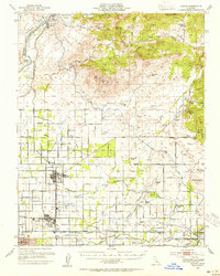
1946 Map of Clovis
USGS Topo · Published 1955About this map
The San Joaquin River and the newly created Millerton Lake dominate the northern landscape of this post-war survey, documenting a pivotal moment in California's water history. The massive Friant-Kern Canal and Friant-Madera Canal branch out from the Friant Dam Spillway 578, cutting through the foothills to irrigate the San Joaquin Valley. To the south, the city of Clovis is shown at a smaller scale before its major suburban expansion, still surrounded by agricultural colony ditches like the Kutner Colony Ditch and Topeka Ditch.
Find a feature on this map
100 named features on this map. Tap any name to fly to it.
Don’t see what you’re looking for? This feature index may not catch every label — zoom into the map to look around manually.
Map Details
Editions of this 1946 Clovis Map
This is the sole edition of this map. No revisions or reprints were ever made.
Other maps of this area

1904 · Kaiser
USGS Topo · 1:125,000

1912 · Mariposa
USGS Topo · 1:125,000

1916 · Sulphur Springs
USGS Topo · 1:24,000

1919 · Sulphur Springs
USGS Topo · 1:31,680

1919 · Little Table Mountain
USGS Topo · 1:31,680

1920 · Orangedale School
USGS Topo · 1:24,000

1921 · Bullard
USGS Topo · 1:31,680

1922 · Round Mountain
USGS Topo · 1:31,680

1922 · Trimmer
USGS Topo · 1:96,000

1922 · Lanes Bridge
USGS Topo · 1:31,680