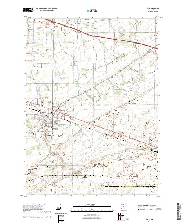
2023 Map of Clyde
USGS Topo · Published 2023About this map
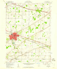
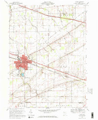
Clyde serves as a central hub in this northern Ohio landscape, where the street grid of the town meets the complex drainage system of the Erie plains. The area is defined by numerous waterways including Pickerel Creek, Raccoon Creek, and Buck Creek, which move through a mosaic of agricultural plots and small settlements. The importance of local civic and religious history is evident in the dense distribution of burial grounds such as McPherson Cem and Saint Marys Cem. Outside the main town center, smaller locales like Wales Corners, Colby, and Mount Carmel anchor the surrounding rural sections. The northern edge of Bellevue appears on the eastern margin, while the Sandusky County Courthouse - District Number One marks a significant local landmark. This survey captures the region's long-established township structure, spanning from t5n r16e south to the border shared by Sandusky County and Seneca County.
Find a feature on this map
101 named features on this map. Tap any name to fly to it.
Don’t see what you’re looking for? This feature index may not catch every label — zoom into the map to look around manually.
Map Details
Editions of this 2023 Clyde Map
This is the sole edition of this map. No revisions or reprints were ever made.