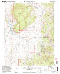
2001 Map of Cochetopa Park
USGS Topo · Published 2004About this map
The Cochetopa Dome rises as a central geological feature in this portion of the Cochetopa Hills, where high-altitude water management is evident through the Lower Dome Reservoir and Upper Dome Reservoir. The landscape is a critical hydraulic junction, with waters feeding into Cochetopa Creek and the Saguache Creek headwaters. Human presence is sparse but concentrated at the Quarter Circle Ranch and supported by infrastructure like a Landing Strip. The map illustrates the intersection of several managed lands, including the Dome Lakes State Wildlife Area and the Gunnison National Forest. Significant for outdoor historians, the Colorado Trail winds through the southern reaches of the quadrangle, crossing the Continental Divide as it traverses the high-country terrain between Mexican Joe Gulch and Monchego Creek.
Find a feature on this map
32 named features on this map. Tap any name to fly to it.
Don’t see what you’re looking for? This feature index may not catch every label — zoom into the map to look around manually.
Map Details
Editions of this 2001 Cochetopa Park Map
This is the sole edition of this map. No revisions or reprints were ever made.
Other maps of this area

1956 · Montrose
USGS Topo · 1:250,000

1959 · Montrose
USGS Topo · 1:250,000

1960 · Montrose
USGS Topo · 1:250,000

1962 · West Baldy
USGS Topo · 1:24,000

1962 · Razor Creek Dome
USGS Topo · 1:24,000
1962 · Sawtooth Mountain
USGS Topo · 1:24,000
1965 · Cold Spring Park
USGS Topo · 1:24,000
1965 · Elk Park
USGS Topo · 1:24,000
1967 · North Pass
USGS Topo · 1:24,000
1967 · Grouse Creek
USGS Topo · 1:24,000