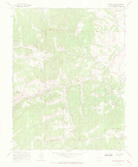
1967 Map of Grouse Creek
USGS Topo · Published 1969About this map
The Rio Grande National Forest dominates this high-altitude landscape, where the headwaters of several major drainages converge near the continental divide. In the late 1960s, this area remained largely inaccessible to vehicles, defined instead by a network of Pack Trails and Jeep Trails that followed the natural contours of the drainages. The hydrology is particularly intricate here, with the East Fork Rio Grande and West Fork Rio Grande emerging in the northwest, while the southeastern corner is shaped by Saguache Creek and the thermal presence of Hat Springs. Unusual local toponyms like Andys Hole, Anvil, and Lost Park suggest a history of early mountaineering, ranching, or prospecting. The map also traces the rugged descent of California Gulch and Trough Creek, illustrating the complex vertical relief between peaks like Hat Mountain and the deep basin floors.
Find a feature on this map
25 named features on this map. Tap any name to fly to it.
Don’t see what you’re looking for? This feature index may not catch every label — zoom into the map to look around manually.
Map Details
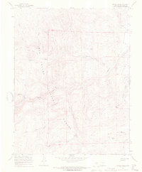
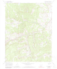
Editions of this 1967 Grouse Creek Map
3 editions found
Other maps of this area

1914 · Creede
USGS Topo · 1:125,000

1915 · Del Norte
USGS Topo · 1:125,000

1916 · Creede
USGS Topo · 1:125,000

1917 · Del Norte
USGS Topo · 1:125,000

1945 · Durango
USGS Topo · 1:250,000

1953 · Durango
USGS Topo · 1:250,000

1954 · Durango
USGS Topo · 1:250,000

1956 · Montrose
USGS Topo · 1:250,000

1959 · Montrose
USGS Topo · 1:250,000

1960 · Montrose
USGS Topo · 1:250,000