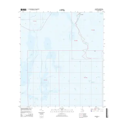
2015 Map of Cocodrie
USGS Topo · Published 2015About this map
Cocodrie serves as a small coastal hub at the edge of the Gulf of Mexico, where the marshlands of Terrebonne Parish meet the open water. This 2015 survey illustrates a landscape dominated by the movement of water and tides, characterized by a complex network of bayous and salt marshes. The Houma Navigation Canal cuts through the northern section, facilitating maritime traffic through the Bayou Petit Caillou corridor. The map details a shifting shoreline where large bodies of water like Terrebonne Bay and Bay Sale are separated by narrow fingers of land and tidal channels such as Sainte Elaine Pass and Tambour Cutoff. For those studying coastal change or local navigation, the placement of landmarks like Cooke Point and the numerous small inlets including Mangrove Bay and Bay Touch-me-not provide essential reference points for the Louisiana coastline.
Find a feature on this map
40 named features on this map. Tap any name to fly to it.
Don’t see what you’re looking for? This feature index may not catch every label — zoom into the map to look around manually.
Map Details
Editions of this 2015 Cocodrie Map
This is the sole edition of this map. No revisions or reprints were ever made.
Other maps of this area

1894 · Bayou De Large
USGS Topo · 1:62,500

1894 · Dulac
USGS Topo · 1:62,500

1935 · Cocodrie
USGS Topo · 1:31,680

1935 · Bourbeux
USGS Topo · 1:31,680

1935 · Lake Quitman
USGS Topo · 1:31,680

1940 · Bayou Du Large
USGS Topo · 1:62,500

1941 · Bayou Du Large
USGS Topo · 1:62,500

1941 · Dulac
USGS Topo · 1:62,500
1944 · Dulac
USGS Topo · 1:62,500

1944 · Bayou Du Large
USGS Topo · 1:62,500