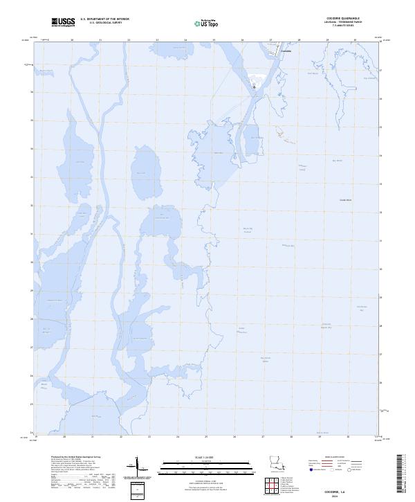
2024 Map of Cocodrie
USGS Topo · Published 2024About this map
The settlement of Cocodrie serves as the primary landward anchor in this labyrinthine coastal landscape of southern Terrebonne Parish. Located at the terminus of the road network, this area is defined by the critical intersection of the Houma Navigation Canal and Bayou Petit Caillou, arteries that support the local maritime and fishing economies. The intricate web of waterways, including Bayou Sale and Oyster Bayou, illustrates the highly fragmented nature of the Louisiana gulf coast, where land and water merge into a complex of marshes and shallow bays.
Find a feature on this map
39 named features on this map. Tap any name to fly to it.
Don’t see what you’re looking for? This feature index may not catch every label — zoom into the map to look around manually.
Map Details
Editions of this 2024 Cocodrie Map
This is the sole edition of this map. No revisions or reprints were ever made.
Other maps of this area

1894 · Bayou De Large
USGS Topo · 1:62,500

1894 · Dulac
USGS Topo · 1:62,500

1935 · Cocodrie
USGS Topo · 1:31,680

1935 · Bourbeux
USGS Topo · 1:31,680

1935 · Lake Quitman
USGS Topo · 1:31,680

1940 · Bayou Du Large
USGS Topo · 1:62,500

1941 · Bayou Du Large
USGS Topo · 1:62,500

1941 · Dulac
USGS Topo · 1:62,500
1944 · Dulac
USGS Topo · 1:62,500

1944 · Bayou Du Large
USGS Topo · 1:62,500