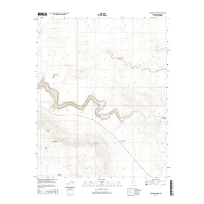
2014 Map of Coconino Point
USGS Topo · Published 2014About this map
The Little Colorado River carves a deep, sinuous path across this high-altitude landscape, dictating the local topography and historical movement through the region. Rising above the river's path are several prominent volcanic and sedimentary formations, including the high summit of Coconino Point and the isolated elevations of Side Mountain and Gray Mountain. To the north, Red Butte stands as a distinct landmark, while the vast expanse of Mormon Tea Flat occupies the southern reaches near Burro Canyon Wash. Infrastructure is sparse in this arid environment, defined primarily by the passage of Highway 64 and the Bureau of Indian Affairs road Bia-6135. The presence of Hopi Trail Canyon indicates long-standing cultural and geographic transit points through the steep canyon walls that dominate the central part of the quadrangle.
Find a feature on this map
14 named features on this map. Tap any name to fly to it.
Don’t see what you’re looking for? This feature index may not catch every label — zoom into the map to look around manually.
Map Details
Editions of this 2014 Coconino Point Map
This is the sole edition of this map. No revisions or reprints were ever made.
Other maps of this area

1886 · San Francisco Mtns
USGS Topo · 1:250,000

1886 · Echo Cliffs
USGS Topo · 1:250,000

1891 · San Francisco Mtns
USGS Topo · 1:250,000

1891 · Echo Cliffs
USGS Topo · 1:250,000

1894 · San Francisco Mtns
USGS Topo · 1:250,000

1899 · San Francisco Mtns
USGS Topo · 1:250,000

1947 · Flagstaff
USGS Topo · 1:250,000

1954 · Flagstaff
USGS Topo · 1:250,000

1955 · Coconino Pt SE
USGS Topo · 1:24,000

1955 · Coconino Pt NE
USGS Topo · 1:24,000