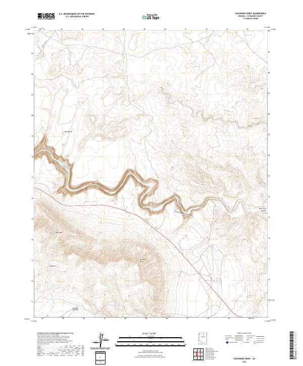
2021 Map of Coconino Point
USGS Topo · Published 2021About this map
Coconino Point rises as the dominant landmark in this high-desert landscape, overlooking the dramatic incision of the Little Colorado River Gorge. The river corridor, which includes the winding Little Colorado River, serves as the primary geographic focal point, cutting through the plateau and creating complex side-drainages such as Hopi Trail Canyon. Higher elevations are marked by distinctive topographical features including Red Butte, Side Mtn, and Gray Mtn, while lower flatlands are identified by names like Mormon Tea Flat. This modern survey illustrates the intersection of indigenous routes and contemporary infrastructure, with Indian Rte 6135 and Route 64 providing access through the region. The map captures a landscape defined by significant vertical relief, where ephemeral drainages like Burro Canyon Wash feed into the deeply carved river system.
Find a feature on this map
15 named features on this map. Tap any name to fly to it.
Don’t see what you’re looking for? This feature index may not catch every label — zoom into the map to look around manually.
Map Details
Editions of this 2021 Coconino Point Map
This is the sole edition of this map. No revisions or reprints were ever made.
Other maps of this area

1886 · San Francisco Mtns
USGS Topo · 1:250,000

1886 · Echo Cliffs
USGS Topo · 1:250,000

1891 · San Francisco Mtns
USGS Topo · 1:250,000

1891 · Echo Cliffs
USGS Topo · 1:250,000

1894 · San Francisco Mtns
USGS Topo · 1:250,000

1899 · San Francisco Mtns
USGS Topo · 1:250,000

1947 · Flagstaff
USGS Topo · 1:250,000

1954 · Flagstaff
USGS Topo · 1:250,000

1955 · Coconino Pt SE
USGS Topo · 1:24,000

1955 · Coconino Pt NE
USGS Topo · 1:24,000