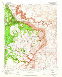
1962 Map of Coconino Point
USGS Topo · Published 1964About this map
The Little Colorado River carves a striking path through this high desert region, defining the transition between the Painted Desert to the northeast and the Coconino Plateau to the southwest. This 1962 survey, produced in cooperation with the Atomic Energy Commission, documents a landscape where traditional indigenous lands of the Navajo Indian Reservation meet the Kaibab National Forest. Notable for its physical geography, the map details the dramatic Coconino Gorge and landmarks like Coconino Point and Saddle Horn Rock. Cultural evidence is marked by ancient Petroglyphs and isolated modern outposts like Willows Camp and Needmore. The region's reliance on water management is evident through the naming of numerous stock tanks such as Muggs Castle Tank and Rough House Tank, and the presence of a Gaging Station and Cable Crossing along the river.
Find a feature on this map
55 named features on this map. Tap any name to fly to it.
Don’t see what you’re looking for? This feature index may not catch every label — zoom into the map to look around manually.
Map Details
Editions of this 1962 Coconino Point Map
This is the sole edition of this map. No revisions or reprints were ever made.
Other maps of this area

1886 · San Francisco Mtns
USGS Topo · 1:250,000

1886 · Echo Cliffs
USGS Topo · 1:250,000

1891 · San Francisco Mtns
USGS Topo · 1:250,000

1891 · Echo Cliffs
USGS Topo · 1:250,000

1894 · San Francisco Mtns
USGS Topo · 1:250,000

1899 · San Francisco Mtns
USGS Topo · 1:250,000

1907 · Vishnu
USGS Topo · 1:48,000

1947 · Flagstaff
USGS Topo · 1:250,000

1954 · Flagstaff
USGS Topo · 1:250,000

1955 · Coconino Pt SE
USGS Topo · 1:24,000