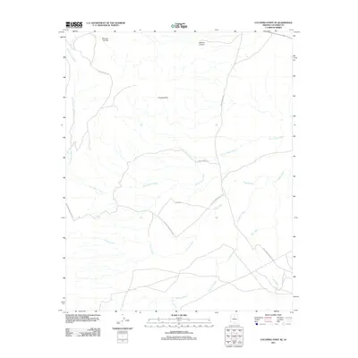
2011 Map of Coconino Point SE
USGS Topo · Published 2011About this map
Coconino Rim dominates the central landscape of this high desert region in Coconino County. The map details an arid environment defined by a network of drainage systems, including the extensive Burro Canyon Wash and Tappan Wash that channel seasonal runoff across the plateau. To the north, Mormon Tea Flat and Pothole Canyon provide distinct topographical landmarks within this sparsely settled territory. Human presence is primarily indicated by a system of primitive routes and access ways, such as the Gray Mountain Truck Trl and various Forest Service Rd paths. These tracks connect the remote washes, including Needmore Wash and Cedar Wash, reflecting the region's historical use for ranching and resource management rather than permanent habitation.
Find a feature on this map
11 named features on this map. Tap any name to fly to it.
Don’t see what you’re looking for? This feature index may not catch every label — zoom into the map to look around manually.
Map Details
Editions of this 2011 Coconino Point SE Map
This is the sole edition of this map. No revisions or reprints were ever made.
Other maps of this area

1886 · San Francisco Mtns
USGS Topo · 1:250,000

1891 · San Francisco Mtns
USGS Topo · 1:250,000

1894 · San Francisco Mtns
USGS Topo · 1:250,000

1899 · San Francisco Mtns
USGS Topo · 1:250,000

1947 · Flagstaff
USGS Topo · 1:250,000

1954 · Flagstaff
USGS Topo · 1:250,000

1955 · Coconino Pt SE
USGS Topo · 1:24,000

1955 · Coconino Pt NE
USGS Topo · 1:24,000

1955 · Cameron SW
USGS Topo · 1:24,000

1955 · Cameron
USGS Topo · 1:62,500