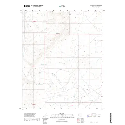
2018 Map of Coconino Point SE
USGS Topo · Published 2018About this map
Coconino Rim dominates the topography of this high-desert landscape, creating a dramatic natural boundary that separates the northern plateau from the lower drainage basins to the south. This environment is defined by an intricate network of seasonal watercourses, including the extensive Burro Canyon Wash and Tappan Wash, which carve through the arid terrain. The map captures a transition in elevation near Gray Mtn and across the open expanse of Mormon Tea Flat, providing a detailed view of the remote territory before the land drops into Pothole Canyon. Infrastructure is minimal in this region, limited primarily to back-country routes like Indian Rte 6150 and Rd 6150. These tracks suggest the area's continued use for local transit and livestock management within the varied townships of the Coconino County wilderness.
Find a feature on this map
17 named features on this map. Tap any name to fly to it.
Don’t see what you’re looking for? This feature index may not catch every label — zoom into the map to look around manually.
Map Details
Editions of this 2018 Coconino Point SE Map
This is the sole edition of this map. No revisions or reprints were ever made.
Other maps of this area

1886 · San Francisco Mtns
USGS Topo · 1:250,000

1891 · San Francisco Mtns
USGS Topo · 1:250,000

1894 · San Francisco Mtns
USGS Topo · 1:250,000

1899 · San Francisco Mtns
USGS Topo · 1:250,000

1947 · Flagstaff
USGS Topo · 1:250,000

1954 · Flagstaff
USGS Topo · 1:250,000

1955 · Coconino Pt SE
USGS Topo · 1:24,000

1955 · Coconino Pt NE
USGS Topo · 1:24,000

1955 · Cameron SW
USGS Topo · 1:24,000

1955 · Cameron
USGS Topo · 1:62,500