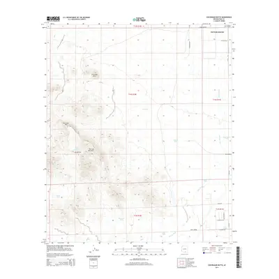
2014 Map of Cocoraque Butte
USGS Topo · Published 2014About this map
Roskruge Mountains dominate the western portion of this 2014 survey, providing a sharp topographical contrast to the broad alluvial plains of Avra Valley and Altar Valley. The map details a complex network of ephemeral drainage and water management essential for desert life, centered around the prominent Cocoraque Butte. While Picture Rocks sits in the northeast corner with emerging residential road systems like W Calle Pima, much of the landscape remains defined by ranching and desert infrastructure. A series of named reservoirs and catchments, including Batamote Tank, Cat Tank, and Filtro Tank, are scattered across the terrain to capture runoff from heights like Recortado Mtn. The seasonal Brawley Wash serves as the primary drainage artery, flanked by thoroughfares such as N Reservation Rd and S Avra Rd which connect the disparate valley settlements.
Find a feature on this map
31 named features on this map. Tap any name to fly to it.
Don’t see what you’re looking for? This feature index may not catch every label — zoom into the map to look around manually.
Map Details
Editions of this 2014 Cocoraque Butte Map
This is the sole edition of this map. No revisions or reprints were ever made.
Other maps of this area

1925 · San Xavier
USGS Topo · 1:62,500

1934 · Tucson Mountains
USGS Topo · 1:125,000

1941 · Cocoraque Butte
USGS Topo · 1:62,500

1943 · Cocoraque Butte
USGS Topo · 1:62,500

1943 · San Xavier Mission
USGS Topo · 1:62,500

1947 · Cortaro
USGS Topo · 1:62,500

1956 · Tucson
USGS Topo · 1:250,000

1957 · San Xavier Mission
USGS Topo · 1:62,500

1957 · Cortaro
USGS Topo · 1:62,500

1958 · Tucson
USGS Topo · 1:250,000