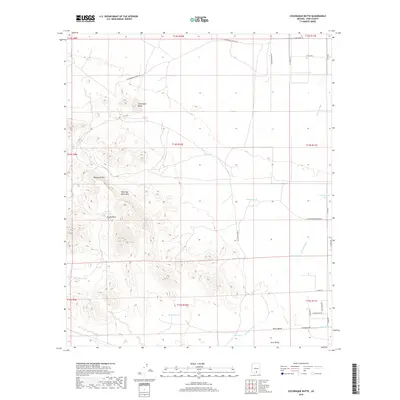
2018 Map of Cocoraque Butte
USGS Topo · Published 2018About this map
Cocoraque Butte stands as a prominent landmark in the Roskruge Mountains, overlooking a landscape defined by desert hydrology and ranching infrastructure. This high-desert region in Pima County transitions between the Altar Valley and Avra Valley, where the drainage of Brawley Wash dictates the movement of water across the arid floor. The distribution of man-made catchments like Batamote Tank, Ramon Tank, and Twin Tanks reveals the critical importance of water management for local land use.
Find a feature on this map
39 named features on this map. Tap any name to fly to it.
Don’t see what you’re looking for? This feature index may not catch every label — zoom into the map to look around manually.
Map Details
Editions of this 2018 Cocoraque Butte Map
This is the sole edition of this map. No revisions or reprints were ever made.
Other maps of this area

1925 · San Xavier
USGS Topo · 1:62,500

1934 · Tucson Mountains
USGS Topo · 1:125,000

1941 · Cocoraque Butte
USGS Topo · 1:62,500

1943 · Cocoraque Butte
USGS Topo · 1:62,500

1943 · San Xavier Mission
USGS Topo · 1:62,500

1947 · Cortaro
USGS Topo · 1:62,500

1956 · Tucson
USGS Topo · 1:250,000

1957 · San Xavier Mission
USGS Topo · 1:62,500

1957 · Cortaro
USGS Topo · 1:62,500

1958 · Tucson
USGS Topo · 1:250,000