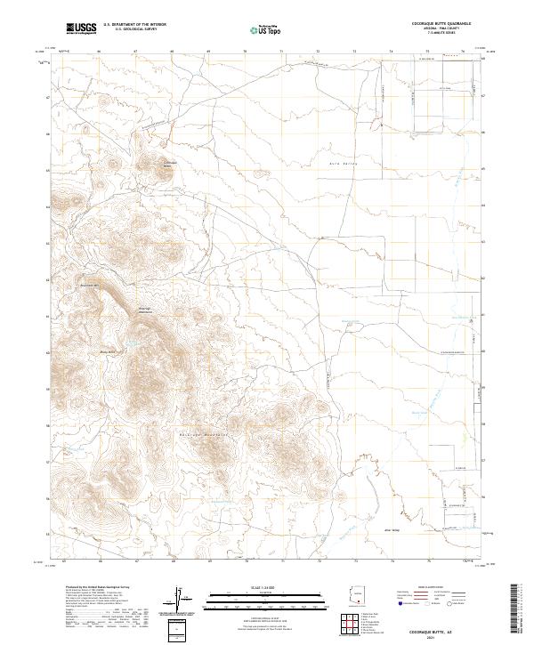
2021 Map of Cocoraque Butte
USGS Topo · Published 2021About this map
Cocoraque Butte rises prominently above the desert floor of the Avra Valley, serving as a focal point for this arid Pima County landscape. The terrain is defined by the sharp elevations of the Roskruge Mountains and Recortado Mtn, which separate the broader basins of the Altar Valley to the south. Water management is a central theme of this region, evidenced by the numerous catchments and tanks distributed across the foothills, including Batamote Tank, Filtro Tank, and San Patricio Tank. These features, along with the drainage of Brawley Wash, underscore the necessities of ranching and land use in the Sonoran Desert. The map also traces a network of rural routes such as W Cocoraque Ranch Rd and W Donaldson Ranch Rd, which provide access to this isolated but surveyed desert environment.
Find a feature on this map
40 named features on this map. Tap any name to fly to it.
Don’t see what you’re looking for? This feature index may not catch every label — zoom into the map to look around manually.
Map Details
Editions of this 2021 Cocoraque Butte Map
This is the sole edition of this map. No revisions or reprints were ever made.
Other maps of this area

1925 · San Xavier
USGS Topo · 1:62,500

1934 · Tucson Mountains
USGS Topo · 1:125,000

1941 · Cocoraque Butte
USGS Topo · 1:62,500

1943 · Cocoraque Butte
USGS Topo · 1:62,500

1943 · San Xavier Mission
USGS Topo · 1:62,500

1947 · Cortaro
USGS Topo · 1:62,500

1956 · Tucson
USGS Topo · 1:250,000

1957 · San Xavier Mission
USGS Topo · 1:62,500

1957 · Cortaro
USGS Topo · 1:62,500

1958 · Tucson
USGS Topo · 1:250,000