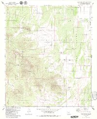
1979 Map of Cocoraque Butte
USGS Topo · Published 1980About this map
The Papago Indian Reservation dominates this high-desert landscape in Pima County, where the stark topography of the Roskruge Mountains meets the wide expanse of the Avra Valley. The map details a scattered pastoral infrastructure essential for survival in the arid environment, marked by numerous water features such as the San Patricio Tank, Batamote Tank, and several wells. Life in this part of Arizona during the 1970s was anchored by family-named ranching operations, including the Cocoraque Ranch, Garcia Ranch, and Donaldson Ranch.
Find a feature on this map
36 named features on this map. Tap any name to fly to it.
Don’t see what you’re looking for? This feature index may not catch every label — zoom into the map to look around manually.
Map Details
Editions of this 1979 Cocoraque Butte Map
This is the sole edition of this map. No revisions or reprints were ever made.
Other maps of this area

1925 · San Xavier
USGS Topo · 1:62,500

1934 · Tucson Mountains
USGS Topo · 1:125,000

1941 · Cocoraque Butte
USGS Topo · 1:62,500

1943 · Cocoraque Butte
USGS Topo · 1:62,500

1943 · San Xavier Mission
USGS Topo · 1:62,500

1947 · Cortaro
USGS Topo · 1:62,500

1956 · Tucson
USGS Topo · 1:250,000

1957 · San Xavier Mission
USGS Topo · 1:62,500

1957 · Cortaro
USGS Topo · 1:62,500

1958 · Tucson
USGS Topo · 1:250,000