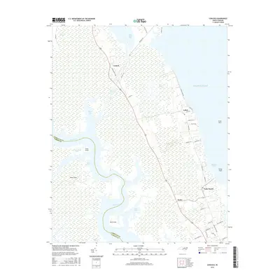
2016 Map of Coinjock
USGS Topo · Published 2016About this map
Coinjock and the surrounding marshlands of Currituck County are defined by the critical transit corridor of the Intracoastal Waterway, which cuts through the low-lying peninsula. This 2016 survey illustrates the intricate network of water and wetlands that characterize the Outer Banks region, featuring extensive areas like Great Swamp, Maple Swamp, and Laurel Swamp. These ecological features are interspersed with small, established coastal settlements including Aydlett, Bertha, and Poplar Branch.
Find a feature on this map
47 named features on this map. Tap any name to fly to it.
Don’t see what you’re looking for? This feature index may not catch every label — zoom into the map to look around manually.
Map Details
Editions of this 2016 Coinjock Map
This is the sole edition of this map. No revisions or reprints were ever made.
Other maps of this area

1940 · Barco
USGS Topo · 1:62,500

1940 · Powells Point
USGS Topo · 1:62,500

1940 · Wade Point
USGS Topo · 1:62,500

1943 · Wade Point
USGS Topo · 1:62,500

1946 · Eastville
USGS Topo · 1:250,000

1946 · Currituck Sound
USGS Topo · 1:250,000

1948 · Wade Point
USGS Topo · 1:62,500

1948 · Elizabeth City
USGS Topo · 1:62,500

1953 · Norfolk
USGS Topo · 1:250,000

1961 · Eastville
USGS Topo · 1:250,000