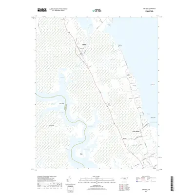
2019 Map of Coinjock
USGS Topo · Published 2019About this map
Coinjock serves as a central hub in this coastal landscape, situated along the critical path of the Intracoastal Waterway. This area of the Inner Banks is defined by its intricate network of wetlands and tidal waters, including the North River, Currituck Sound, and Piney Island Bay. The settlement pattern reflects a long history of maritime and agricultural life, with small communities like Aydlett and Poplar Branch connected by local thoroughfares such as Aydlett Rd and Narrow Shore Rd.
Find a feature on this map
63 named features on this map. Tap any name to fly to it.
Don’t see what you’re looking for? This feature index may not catch every label — zoom into the map to look around manually.
Map Details
Editions of this 2019 Coinjock Map
This is the sole edition of this map. No revisions or reprints were ever made.
Other maps of this area

1940 · Barco
USGS Topo · 1:62,500

1940 · Powells Point
USGS Topo · 1:62,500

1940 · Wade Point
USGS Topo · 1:62,500

1943 · Wade Point
USGS Topo · 1:62,500

1946 · Eastville
USGS Topo · 1:250,000

1946 · Currituck Sound
USGS Topo · 1:250,000

1948 · Wade Point
USGS Topo · 1:62,500

1948 · Elizabeth City
USGS Topo · 1:62,500

1953 · Norfolk
USGS Topo · 1:250,000

1961 · Eastville
USGS Topo · 1:250,000