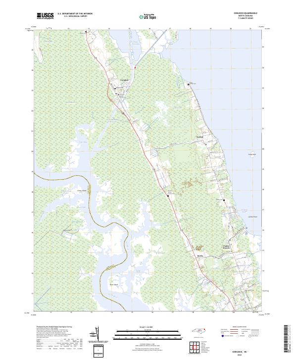
2022 Map of Coinjock
USGS Topo · Published 2022About this map
The Intracoastal Waterway serves as the central artery for this Currituck County landscape, cutting through a mosaic of wetlands including Great Swamp and Maple Swamp. For genealogists, the map is remarkably dense with family-named burial sites, such as the Baum Family Cem and the Charles Wilson Forbes Cem, which suggest long-standing lineages tied to these coastal marshes. The settlements of Coinjock and Aydlett are situated along the margins of the North River and Piney Island Bay, illustrating how historical development has remained anchored to the shoreline. This 2022 survey documents the persistent rural character of the region, where community life centers around established landmarks like the Coinjock Baptist Church and small cross-road hamlets like Bertha and Poplar Branch. Isolated landforms like Indian Island and Buck Island further define the intricate water-and-land interface of the North Carolina coast.
Find a feature on this map
57 named features on this map. Tap any name to fly to it.
Don’t see what you’re looking for? This feature index may not catch every label — zoom into the map to look around manually.
Map Details
Editions of this 2022 Coinjock Map
This is the sole edition of this map. No revisions or reprints were ever made.
Other maps of this area

1940 · Barco
USGS Topo · 1:62,500

1940 · Powells Point
USGS Topo · 1:62,500

1940 · Wade Point
USGS Topo · 1:62,500

1943 · Wade Point
USGS Topo · 1:62,500

1946 · Eastville
USGS Topo · 1:250,000

1946 · Currituck Sound
USGS Topo · 1:250,000

1948 · Wade Point
USGS Topo · 1:62,500

1948 · Elizabeth City
USGS Topo · 1:62,500

1953 · Norfolk
USGS Topo · 1:250,000

1961 · Eastville
USGS Topo · 1:250,000