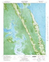
1982 Map of Coinjock
USGS Topo · Published 1983About this map
Coinjock serves as a focal point along the Intracoastal Waterway, where the water-dependent economy of Currituck County is clearly etched into the landscape. This 1982 orthophotomap combines traditional topographic contours with aerial imagery, revealing the tight relationship between the linear settlements and the surrounding wetlands. Life here is oriented toward the water, from the U.S. Coast Guard Station near the bridge to the Poplar Branch Landing on the sound side. The map documents numerous small family cemeteries and religious landmarks like Center Chapel and Sharon Ch, alongside the local Griggs Sch. Extensive tracts of Maple Swamp and Great Swamp isolate these communities on narrow ridges of high ground, creating a distinct cultural geography defined by the North River and the expansive Currituck Sound.
Find a feature on this map
57 named features on this map. Tap any name to fly to it.
Don’t see what you’re looking for? This feature index may not catch every label — zoom into the map to look around manually.
Map Details
Editions of this 1982 Coinjock Map
This is the sole edition of this map. No revisions or reprints were ever made.
Other maps of this area

1940 · Barco
USGS Topo · 1:62,500

1940 · Powells Point
USGS Topo · 1:62,500

1940 · Wade Point
USGS Topo · 1:62,500

1943 · Wade Point
USGS Topo · 1:62,500

1946 · Eastville
USGS Topo · 1:250,000

1946 · Currituck Sound
USGS Topo · 1:250,000

1948 · Wade Point
USGS Topo · 1:62,500

1948 · Elizabeth City
USGS Topo · 1:62,500

1953 · Norfolk
USGS Topo · 1:250,000

1961 · Eastville
USGS Topo · 1:250,000