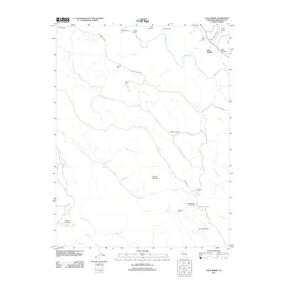
2012 Map of Cold Spring
USGS Topo · Published 2012About this map
The Navarro River and Greenwood Cr define the drainage of this coastal Mendocino County landscape, where the interior terrain is marked by high ridges and family ranches. High-elevation landmarks like Cold Spring Mountain and the Cold Springs Fire Lookout provide overlooking views of the McAllister Ridge and S Fork Greenwood Cr. The map captures a transition between the lower river valleys and the upland clearings, specifically identified as openings in the timber, including Kane Opening, Hamilton Opening, and Brushy Opening. Ranching heritage is deeply rooted in this region, with numerous named properties such as Fashauer Ranch, Anderson Ranch, and McAllister Ranch scattered across the ridges. Roadways like Philo Greenwood Rd and Signal Ridge Rd follow the natural topography, connecting these isolated settlements and guest ranches to the larger river network.
Find a feature on this map
43 named features on this map. Tap any name to fly to it.
Don’t see what you’re looking for? This feature index may not catch every label — zoom into the map to look around manually.
Map Details
Editions of this 2012 Cold Spring Map
This is the sole edition of this map. No revisions or reprints were ever made.
Other maps of this area

1943 · Point Arena
USGS Topo · 1:62,500

1943 · Boonville
USGS Topo · 1:62,500

1943 · Navarro
USGS Topo · 1:62,500

1943 · Ornbaun
USGS Topo · 1:62,500

1944 · Saddle Point
USGS Topo · 1:62,500

1944 · Ornbaun
USGS Topo · 1:62,500

1947 · Santa Rosa
USGS Topo · 1:250,000

1949 · Santa Rosa
USGS Topo · 1:250,000

1957 · Ukiah
USGS Topo · 1:250,000

1958 · Santa Rosa
USGS Topo · 1:250,000