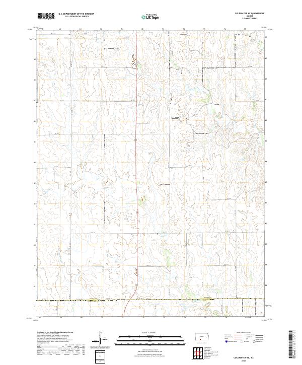
2022 Map of Coldwater NE
USGS Topo · Published 2022About this map
Medicine Lodge River winds through the northern portion of this landscape, carving a subtle path through the drainage patterns of south-central Kansas. This 2022 survey captures the region as it transitions from the high plains into the breaks, where seasonal drainages like Mule Cr cut across the township lines. The area is defined by a rigid grid of section roads and the prominent north-south corridor of 183, which serves as the primary artery through this rural expanse. On the southern edge of the map, the boundary between Kiowa Co and Comanche Co is marked by Co Line Rd, illustrating the intersection of two distinct administrative districts. While primarily a rural and agricultural landscape, the map provides a precise record of the current road network, including remote segments like Cm Ave A and Kc St Q, essential for local history researchers and modern land-use studies.
Find a feature on this map
34 named features on this map. Tap any name to fly to it.
Don’t see what you’re looking for? This feature index may not catch every label — zoom into the map to look around manually.
Map Details
Editions of this 2022 Coldwater NE Map
This is the sole edition of this map. No revisions or reprints were ever made.
Other maps of this area

1889 · Kinsley
USGS Topo · 1:125,000

1892 · Kinsley
USGS Topo · 1:125,000

1892 · Coldwater
USGS Topo · 1:125,000

1894 · Kinsley
USGS Topo · 1:125,000

1955 · Pratt
USGS Topo · 1:250,000

1959 · Pratt
USGS Topo · 1:250,000

1968 · Brenham
USGS Topo · 1:24,000
1969 · Greensburg
USGS Topo · 1:24,000
1969 · Mullinville
USGS Topo · 1:24,000

1979 · Coldwater
USGS Topo · 1:24,000