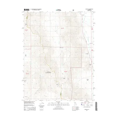
2015 Map of Coleville
USGS Topo · Published 2015About this map
Coleville and Topaz sit on the eastern edge of this 2015 U.S. Geological Survey topographic study, where the high Sierra terrain meets the agricultural corridor of the Antelope Valley. The landscape is defined by the West Walker River, which supports a network of irrigation channels including Swager Ditch and Alkali Ditch. These man-made watercourses are vital to the lower-elevation settlements, contrasting with the steep, high-altitude wilderness to the west within the Toiyabe National Forest.
Find a feature on this map
27 named features on this map. Tap any name to fly to it.
Don’t see what you’re looking for? This feature index may not catch every label — zoom into the map to look around manually.
Map Details
Editions of this 2015 Coleville Map
This is the sole edition of this map. No revisions or reprints were ever made.
Other maps of this area

1889 · Markleeville
USGS Topo · 1:125,000

1891 · Markleeville
USGS Topo · 1:125,000

1891 · Wellington
USGS Topo · 1:125,000

1893 · Markleeville
USGS Topo · 1:125,000

1893 · Wellington
USGS Topo · 1:125,000

1896 · Dardanelles
USGS Topo · 1:125,000

1898 · Dardanelles
USGS Topo · 1:125,000

1909 · Bridgeport
USGS Topo · 1:125,000

1911 · Bridgeport
USGS Topo · 1:125,000

1920 · Bridgeport
USGS Topo · 1:125,000