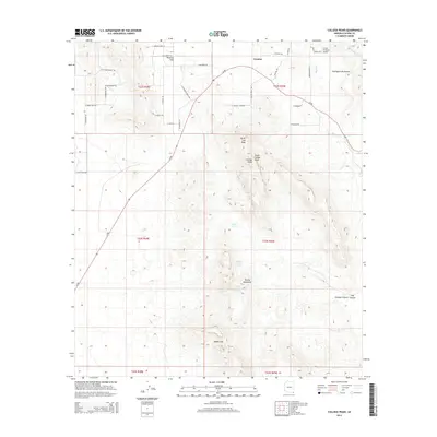
2014 Map of College Peaks
USGS Topo · Published 2014About this map
Cazador and Poverty Flat sit at the northern edge of this high-desert landscape in Cochise County, where the valley floor meets the rising elevations of the Perilla Mountains and the Pedregosa Mountains. The terrain is defined by its arid drainage network, featuring Silver Cr, Wildcat Wash, and the prominent Blackberry Wash in the northeast. This 2014 survey captures the remote character of the region, emphasizing natural water sources such as Lower Tincup Spring and Upper Tincup Spring alongside man-made improvements like Bass Tank. High points such as North Coll Peak and the South Collge Peak provide significant landmarks for navigation. Transportation through this part of the Southwest is anchored by Az-80, which cuts diagonally across the grid of rural roads including N Cazador Trl and Circle H Ranch Rd. The inclusion of the Circle H Ranch Airport highlights the importance of private aviation in accessing these distant ranchlands and mountain passes like Saddle Gap.
Find a feature on this map
47 named features on this map. Tap any name to fly to it.
Don’t see what you’re looking for? This feature index may not catch every label — zoom into the map to look around manually.
Map Details
Editions of this 2014 College Peaks Map
This is the sole edition of this map. No revisions or reprints were ever made.
Other maps of this area

1914 · Douglas
USGS Topo · 1:62,500

1916 · Pearce
USGS Topo · 1:125,000

1916 · Douglas
USGS Topo · 1:125,000

1917 · Chiricahua
USGS Topo · 1:125,000

1919 · Douglas
USGS Topo · 1:125,000

1919 · Perilla
USGS Topo · 1:125,000

1919 · Chiricahua
USGS Topo · 1:125,000

1922 · Swisshelm
USGS Topo · 1:62,500

1925 · Douglas
USGS Topo · 1:62,500

1926 · Pedregosa
USGS Topo · 1:62,500