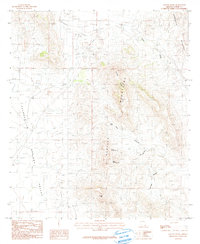
1985 Map of College Peaks
USGS Topo · Published 1986About this map
Poverty Flat and the expansive western reaches of the Sulphur Springs Valley dominate this mid-1980s landscape, illustrating the remote ranching and mining character of Cochise County. The terrain is defined by the sharp rise of the College Peaks Mountains and the Pedregosa Mountains, where vital water sources like Upper Tincup Spring and Lower Tincup Spring provided necessary relief in an arid environment. Evidence of earlier industrial efforts is visible via an Old RR Grade cutting through the flats, while a lone Cem and scattered Prospect markings suggest the small-scale human footprint of the era. The mapping of Hog Canyon and Georges Canyon provides a clear view of the drainage patterns feeding toward Silver Creek at the height of the Cold War era.
Find a feature on this map
17 named features on this map. Tap any name to fly to it.
Don’t see what you’re looking for? This feature index may not catch every label — zoom into the map to look around manually.
Map Details
Editions of this 1985 College Peaks Map
This is the sole edition of this map. No revisions or reprints were ever made.
Other maps of this area

1914 · Douglas
USGS Topo · 1:62,500

1916 · Pearce
USGS Topo · 1:125,000

1916 · Douglas
USGS Topo · 1:125,000

1917 · Chiricahua
USGS Topo · 1:125,000

1919 · Douglas
USGS Topo · 1:125,000

1919 · Perilla
USGS Topo · 1:125,000

1919 · Chiricahua
USGS Topo · 1:125,000

1922 · Swisshelm
USGS Topo · 1:62,500

1925 · Douglas
USGS Topo · 1:62,500

1926 · Pedregosa
USGS Topo · 1:62,500