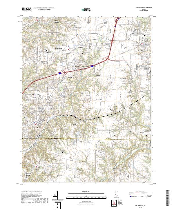
2024 Map of Collinsville
USGS Topo · Published 2024About this map
The boundary between Madison Co and St Clair Co bisects a landscape defined by industrial growth and suburban expansion in this modern survey. The major transit corridors of I-55 and I-70 converge near Troy Junction and Formosa Junction, shaping the development of Collinsville and Troy. For family historians, the area is exceptionally rich in small burial grounds and family-named landmarks, ranging from the Riggin Family Cem and Bohnenstiehl Family Cem to the sprawling Lakeview Memorial Cem. The map tracks the residential fingers of Wilson Heights and Lumaghi Heights as they press into the rural spaces between established towns. Waterways like Canteen Creek and Judys Branch provide the primary natural relief against a grid of increasing density, while several small lakes, including Maryville Fishing Club Lake, offer local recreational points.
Find a feature on this map
63 named features on this map. Tap any name to fly to it.
Don’t see what you’re looking for? This feature index may not catch every label — zoom into the map to look around manually.
Map Details
Editions of this 2024 Collinsville Map
This is the sole edition of this map. No revisions or reprints were ever made.
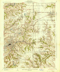
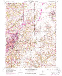
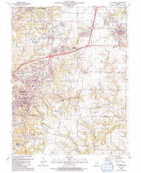
Historical Maps of Troy Through Time
4 maps found