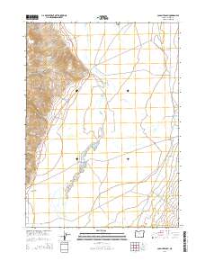
2014 Map of Colony Ranch
USGS Topo · Published 2014About this map
Pueblo Mountains dominate the western edge of this Harney County landscape, giving way to the wide expanse of the Pueblo Valley to the east. The terrain transitions from the high peaks near Red Point down to the alluvial floor of Mapes Flat, a region defined by complex seasonal water systems. The winding path of the Pueblo Slough and various drainage creeks, such as Oliver Cr and Cottonwood Cr, illustrate the hydrologic patterns of the high desert. Settlement is focused at the Colony Ranch, positioned along the Fields Denio Rd at the base of the mountains. This 2014 survey documents the enduring ranching footprint and road networks, including the Cottonwood-Fields Rd, that connect these isolated water sources and grazing lands in the Oregon backcountry.
Find a feature on this map
21 named features on this map. Tap any name to fly to it.
Don’t see what you’re looking for? This feature index may not catch every label — zoom into the map to look around manually.
Map Details
Editions of this 2014 Colony Ranch Map
This is the sole edition of this map. No revisions or reprints were ever made.
Other maps of this area

1886 · Disaster
USGS Topo · 1:250,000

1893 · Disaster
USGS Topo · 1:250,000

1954 · Vya
USGS Topo · 1:250,000

1955 · Adel
USGS Topo · 1:250,000

1957 · Adel
USGS Topo · 1:250,000

1958 · Vya
USGS Topo · 1:250,000

1958 · Adel
USGS Topo · 1:250,000

1961 · Trident Peak
USGS Topo · 1:62,500

1962 · Vya
USGS Topo · 1:250,000

1962 · Adel
USGS Topo · 1:250,000