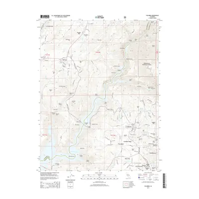
2015 Map of Columbia
USGS Topo · Published 2015About this map
Columbia sits at the heart of this Gold Country landscape, surrounded by a dense network of nineteenth-century mining settlements and cemeteries. The map details the complex water infrastructure essential to the region, from the New Melones Lake reservoir on the Stanislaus National Forest border to historic conduits like the Columbia Ditch and San Diego Ditch. Evidence of the area's rich mining heritage is preserved in the nomenclature of the terrain, with dozens of named gulches including Murderers Gulch, Peruvian Gulch, and Snake Gulch carving through the limestone and volcanic soil. Genealogists will find significant value in the documentation of several local burial grounds, such as the Public Cemetery, Catholic Cemetery, and Shaws Flat Cemetery. The transition from historic mining camp to modern educational hub is evident near Columbia Village, where the Columbia Coll campus and Columbia Airport now occupy land once defined by hydraulic mining and hard-rock claims.
Find a feature on this map
137 named features on this map. Tap any name to fly to it.
Don’t see what you’re looking for? This feature index may not catch every label — zoom into the map to look around manually.
Map Details
Editions of this 2015 Columbia Map
This is the sole edition of this map. No revisions or reprints were ever made.
Other maps of this area

1889 · Jackson
USGS Topo · 1:125,000

1891 · Big Trees
USGS Topo · 1:125,000

1892 · Jackson
USGS Topo · 1:125,000

1893 · Sonora
USGS Topo · 1:125,000

1894 · Big Trees
USGS Topo · 1:125,000

1896 · Sonora
USGS Topo · 1:125,000

1897 · Jackson
USGS Topo · 1:125,000

1897 · Sonora
USGS Topo · 1:125,000

1897 · Big Trees
USGS Topo · 1:125,000

1898 · Sonora
USGS Topo · 1:125,000