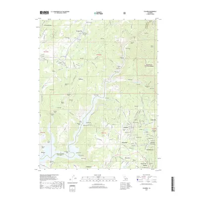
2018 Map of Columbia
USGS Topo · Published 2018About this map
Vallecito and the historic settlement of Columbia anchor this detailed study of the Mother Lode region, showing a landscape defined by its mining heritage and rugged topography. The terrain is marked by numerous gold-rush era features, including the Experimental Mine and dozens of named gulches like Matelot Gulch and Grizzly Gulch. The Stanislaus River winds through the center, separating Calaveras Co from Tuolumne Co, with notable river landmarks such as Duck Bar and Otter Bar visible. Significant local infrastructure is present, from the Columbia Airport to educational sites like Columbia College. For genealogists, the map provides precise locations for several burial grounds, including Vallecito Cem Number 1 and Saint Anne's Catholic Cem. The surrounding environment is characterized by distinctive formations like Table Mtn and the sprawling Stanislaus National Forest, reflecting the area's transition from an industrial mining hub to a region of preserved history.
Find a feature on this map
167 named features on this map. Tap any name to fly to it.
Don’t see what you’re looking for? This feature index may not catch every label — zoom into the map to look around manually.
Map Details
Editions of this 2018 Columbia Map
This is the sole edition of this map. No revisions or reprints were ever made.
Other maps of this area

1889 · Jackson
USGS Topo · 1:125,000

1891 · Big Trees
USGS Topo · 1:125,000

1892 · Jackson
USGS Topo · 1:125,000

1893 · Sonora
USGS Topo · 1:125,000

1894 · Big Trees
USGS Topo · 1:125,000

1896 · Sonora
USGS Topo · 1:125,000

1897 · Jackson
USGS Topo · 1:125,000

1897 · Sonora
USGS Topo · 1:125,000

1897 · Big Trees
USGS Topo · 1:125,000

1898 · Sonora
USGS Topo · 1:125,000